Dear Friends,
More interesting thoughts from Joseph. Paste the link if you don't receive the images.
http://www.marsanomalyresearch.com/evidence-reports/2009/168/forest-life-12.htm
Love and Light.
David
MARS FOREST LIFE
BIO-DIVERSITY-12
Report #168
August 30, 2009
Joseph P. Skipper
J. P. Skipper can be contacted at: jskipper@marsanomalyresearch.com
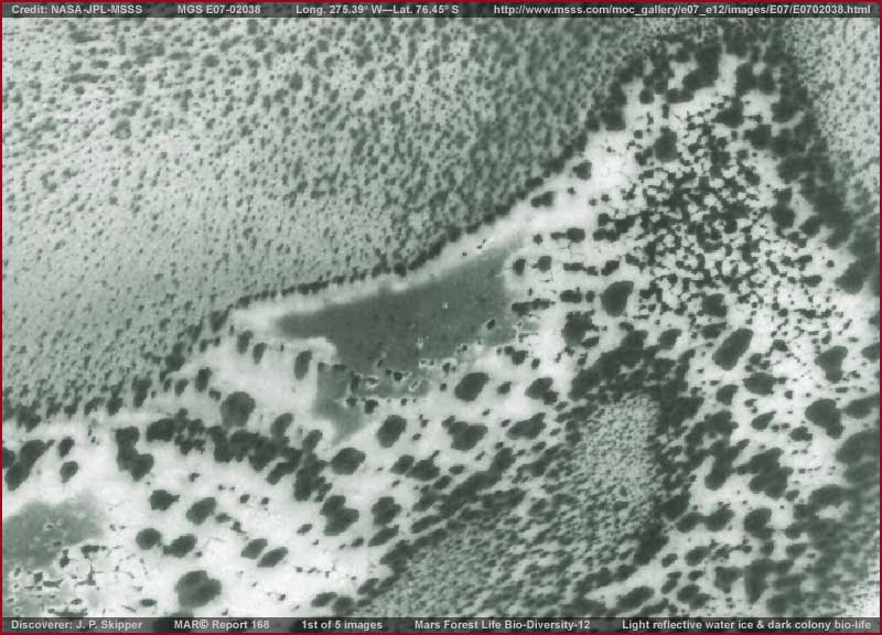
This report derives from a single MGS MOC E07-02038 image strip of a site in the South Polar Region but well out from the Polar Cap. The view in all the report images here is from one side edge of the strip to the other encompassing as much context information as possible. The general terrain around this site area is characterized by lowlands that tend to shallow water wet conditions at certain times with most of the water sinking into the soil. When dryer colder time comes, what water is left on the surface freezes into low level areas of water ice and the sub-soil is infused with water ice.
An example of this is what you are seeing in the above first image. The most light reflective areas above are low level water ice on the ground surface while the less light reflective areas around it is dryer terrain. This dryer terrain is dryer only in a relative sense to the more light reflective water ice on top of the ground. In warmer periods, the water ice partially melts into these lower profile looking surface ice area shapes soaking into the terrain tending to infuse the relatively dryer terrain with moisture.
As you might logically surmise, the fairly plentiful presence of moisture in this terrain logically creates good conditions for the presence of biological life to take advantage of it. That is what you are looking at with respect to the different dark spots you see both in the terrain and on the more light reflective water ice. Most of this is colony life and particularly that on the water ice. The following report images presented here will represent samples of this living ecology further down the strip below this point. Not included here is very light reflective terrain in the upper half of the strip where reflectivity tends to wash out all evidence detail.
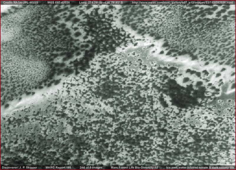
The above second image demonstrates a sample site below that presented in the first image. It is just more of the same but now note with less in larger area water ice on the surface and more dark biological life presence. Note that the dark bio-life here is not really mature enough and therefore large enough to be seen with better visual detail. Also note how the more light reflective but residual water ice tends to collect in the lower level areas tending to form depression like channels in the terrain.
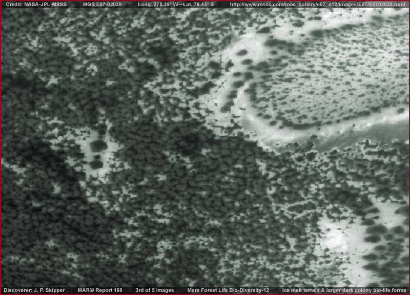
The above third image is a spot a little further down in the strip below the first and second image sites. Now in the left and center areas note that we see the beginning presence of a larger and a bit more mature form of what I call "clump" biological life evidence. From a distant view above like this, the evidence tends to look a little like individual tree tops but it is not a vegetative life forms like trees.
Rather, it and its variations are colony major life forms of some kind unique to this planet. This type of life comes in a number of variations that are also very cold hardy. The variation seen here in this strip is adapted to these South Polar region lowland conditions and look like this but there are others. In my 2001 Report #021 are larger forms looking very much like this but adapted to highland terrain steep slopes. Also here in Report #110 is very similar evidence and again in Report #122 where the evidence is filling shallow trough systems on the South Polar Cap ice itself. This life form is extremely tough and hardy but always consider that it requires plentiful and consistent moisture presence.
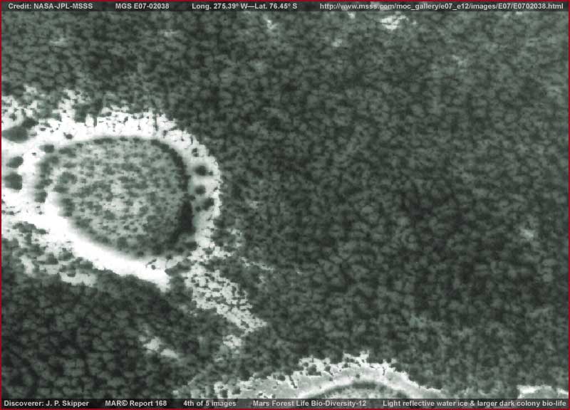
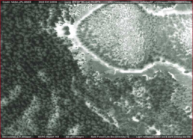
I would say that that most of this terrain is sort of like a drying and not entirely wet bog here on Earth. Whether you can buy into that moist terrain concept or not, the one prevalent thing that cannot be missed here is that the darker clumpy looking evidence is clearly not natural rock and soil geology and just as clearly represents some form of biological living growth in this terrain.
It isn't really doing it so much here in these scenes but this type of Mars life in its more mature form can literally jamb into a given area with one colony form pressing tightly against its neighbors completely filling any sunlight space. However, it never mixes with each other and collectively forms a pretty much level field of this evidence. Some gigantic variations of this life form are so broad and of such a low level elevation that they can be and are easily mistaken for cracked geological terrain on Mars.
When partially covered with snow that removes visible surface detail and leaves only the narrow separation cracks between the colonies visible, this cracked terrain impression is even more acute. Then only the huge size of the formations give scientists pause in speculation as to what forces could cause such monstrous geological cracking and especially in such uniform patterns?
What needs to be understood is that water presence is much more prevalent in the South Polar Region than in the North Polar Region. In fact, some lowland areas of the South Polar Region are subject to seasonal flooding spreading out from the Cap with a rising water table in seasonal and general warming trends. This means that there is a greater variety of biological life present in the South Polar Region than in the North Polar Region taking advantage of these more favorable conditions. In many places in the South Polar Region the lowland soil areas tend to have a fairly high residual moisture content year round that is more favorable for smaller size bio-life that carpets the terrain choking out everything else and that smaller life tends to be sunlight reflective rather than dark and light absorbing.
So when resolution is cut in an image to facilitate obfuscation, it is this type of smaller carpeting life that is the most negatively impacted. The visuals are so merged together by the poor resolution and the sunlight reflectivity that the carpeting life looks more like continuous barren terrain. The upper portion of this same reporting strip is like that. I don't show it here because the only thing to see is light reflectivity off of broad surface areas with little or no individual detail.
By contrast, the bio-life evidence pointed out here is both far larger and darker giving some idea of individual shapes and then better visual recognition follows. We here on Earth tend to think of dense forests as consisting of trees and bushes as per our direct experience. However, although there are conventional looking trees and bushes on Mars, there are also dense forests of what appears to be mold and lichen like colony life in mega size forms that tend to hug and carpet broad areas of terrain where the moist conditions are more favorable to them.
They are one of the prevalent life forms on Mars even if they are unfamiliar to the Earth human eye and not easy for us to visually recognize. The wind carried reproductive spores cover vast areas resulting in the dark spots seen everywhere in various stages from small and struggling to survive to flourishing large densely packed forms covering broad areas. They usually do best where moisture is consistently present in the soil and second best when water ice on the surface is low profile and subject to warming conditions melt. In their variety, they even contaminate and survive within surface water on the South Polar Cap itself forming dark lanes in their millions that retain solar heat that in turn erodes the Cap surfaces.
I come back to reporting on this evidence on occasions just because it is strange and less obvious to the Earth human eye and therefore a little too easy to be ignored because it is not understood. To adequately understand Mars, one must also come to terms with understanding its unique biological life differences that play a major role in the planet's development.
DOCUMENTATION
http://www.msss.com/moc_gallery/e07_e12/images/E07/E0702038.html: This link connects you to the official MGS MOC E07-02038 science data 3rd listed stright .GIF strip sourced in this report. The evidence starts in the last 40% of the strip and continues to the very bottom.
Joseph P. Skipper, Investigator
Contact J. P. Skipper
Contact the Webmaster


No comments:
Post a Comment